We hustle out of Nora, hop in our car and head south. Alice directs us through small, little village roads (oy, here we go again!) that are very scenic with the fields covered in a beautiful yellow flowering plant. There are also cactus here…didn’t really think of Sardinia as a cactus climate, but obviously it is, because there are thousands here of several different varieties.
We finally get back on a “main” road, and make our way to Chia where there is one of those towers that dot the island. It is truly beautiful here. The roads traverse through forests and campgrounds and little villages with the coast always near at hand. The Chia Tower is located way up on a hill, accessed by a sandy little pot holed road that Ed navigates slowly.
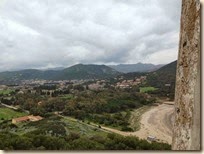
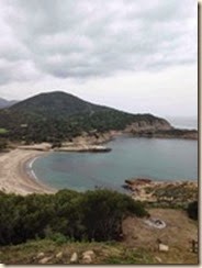
We decide to climb for the scenery and it doesn’t disappoint! On one side is a lagoon, some resort looking houses and a lovely sandy beach.
On the other, more villages, farmland and a cove with more beach.
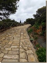
The climb itself, while steep, isn’t too bad (less than 200 foot elevtion change). The laid stone pathway is quite easy to use (as a matter of fact 2 bikers ride up it while we are climbing up the tower steps!). We get the scenic view at the top of the steps, but can’t enter the tower – which is probably best – who knows what might be in there, and how claustrophobic it might be.
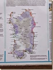
There are about 100 of these towers around the island. Some are used as lighthouses today (as the one in Nora is), but originally they were used to communicate around the island – through fire, smoke or light signals – the islanders would know the news or of impending attack, or whatever, through this system of tower communications. Fascinating. There is even a map that shows all the locations around the island at the top of the path to the Chia Tower.
We get our fill of scenic beauty here and decide not to go any further south up the coast. We want to visit San Sperate , which we’ve read is a town full of murals, and it will take at least an hour to get there from here. So, off we go, back through the little coastal towns and roads and toward Cagliari.
Alice directs us north on some industrial sector road – scenic! Miles and miles of nothing but plants , industrial facilities,windmills and rough pavement from all the heavy trucks. Well, it gets us inland and north at least.
We finally reach another main road that isn’t just industrial (and whoever said there weren’t highways on Sardinia isn’t accurate – this road is a highway – just not as snazzy as the autostradas you are used to in Italy), and then turn off on a side road heading toward San Sperate. And here we go again! The stupid cow paths. What is with this thing! If Alice can find a cow path, she’ll send us on it. I swear! I’m too busy shouting out potholes to even take pictures. Hanging on for dear life, trying to make sure we aren’t swallowed whole in a road pit, while Ed is trying bravely to hug the side of the road to avoid oncoming traffic – who of course are all local (because what fool that wasn’t local would be driving these little back roads???) and drive like idiots. Finally I can see on the stupid map that Alice is taking us onto more cow paths but that our destination can be reached on a real, regular road. Turn right!!
Geez. Well, we finally do get to San Sperate, and we can’t see much to it. Yes, there are murals, but the town itself seems a little sketchy, nothing is open, no one is about, and we’re not feeling it. We do park and take a few quick pictures of a couple murals…
..then we head back to Cagliari to explore the old town until we have to turn the car back in.


No comments:
Post a Comment